

- by

While Baw Baw Extreme is an outdoor event and will proceed in the most of weather conditions we have to plan for different scenarios.
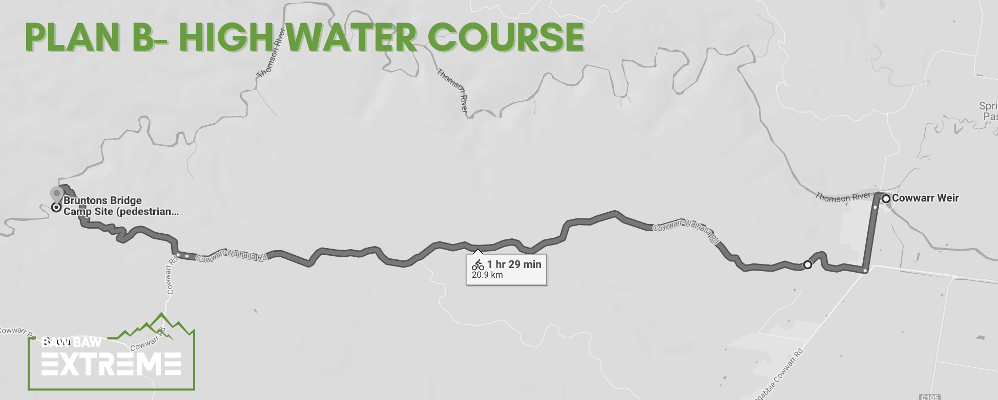
High water route (Plan B)
We will have to follow an alternative paddling course and an additional mtb leg with no first running leg. This will be applicable If the river level is above 0.4 at Coopers crossing. The river level can be checked here>>
In this case the race will start at Cowwarr Weir. The first leg will be a paddle leg mainly on a flat water, out and back to the first rapid (two laps).
The second leg will be a 20.9 km mountain bike leg to Bruntons bridge where you will join a ‘normal course’ and proceed further on towards Erica mtb park and so on.
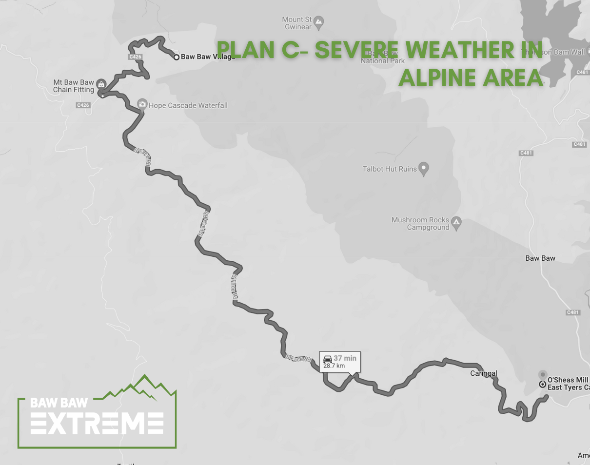
Plan C for the second running leg in case of severe weather
In case of too much snow and strong winds there could be a change of the last trail running leg. The decision will be made on Friday prior the race based on the weather forecast and it will be announced during the briefing. We will make all efforts to avoid this, but your safety is a top priority.
In this case, instead of running on Australian Alps walking trail you will have to follow South Face road all the way up to the resort.
Comments
- No comments found

Leave a comment